
A massive 7.7 magnitude earthquake shook Panama on Friday, triggering a tsunami threat for nine countries along the Pacific coast before the alert was lifted hours later.
Quick Take
- A 7.7 magnitude earthquake struck near Pitaloza Arriba in Panama’s Herrera Province on Friday afternoon.
- The U.S. Tsunami Warning System issued an alert covering Panama, Colombia, Costa Rica, Ecuador, Peru, Nicaragua, Guatemala, El Salvador, and Mexico.
- Forecasters warned waves could reach 3 to 9 feet above normal tide levels in parts of Panama.
- The tsunami warning was canceled later the same day, and Panama declared a major disaster after buildings and roads were damaged.
Quake Strikes Near Panama’s Herrera Province
The earthquake hit at about 1:56 p.m. Eastern time, centered roughly 6 miles southwest of Pitaloza Arriba, according to the U.S. Geological Survey. The agency measured the quake’s depth at about 6 miles underground, a shallow depth that often makes shaking feel stronger at the surface. Shallow, powerful quakes like this one are more likely to disturb the seafloor enough to trigger tsunami concerns.
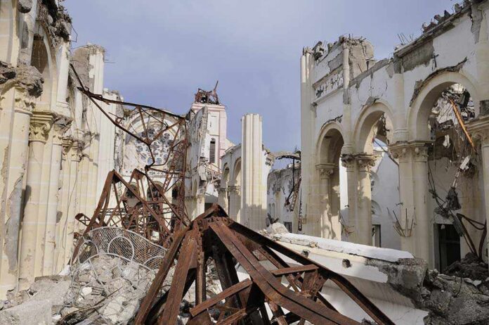
Multiple aftershocks followed the main quake, including one measuring 6.6 in magnitude. Panama’s government responded by declaring a major disaster after the shaking destroyed buildings and damaged roads across affected areas. The scale of destruction pushed emergency crews into immediate action as officials assessed the damage.
Tsunami Threat Spans Nine Countries
The U.S. Tsunami Warning System issued an alert warning that hazardous waves could hit coastlines in Panama, Colombia, Costa Rica, Ecuador, Peru, Nicaragua, Guatemala, El Salvador, and Mexico. Forecasters said parts of Panama’s coast could see waves ranging from 3 to 9 feet above normal tide levels, a height capable of flooding low-lying coastal communities and damaging boats and docks.
Agencies issued the warning within minutes of the quake, giving coastal residents time to move to higher ground. Emergency officials across the region activated evacuation plans as the threat spread beyond Panama’s borders. The warning covered a wide stretch of Pacific coastline, reflecting how far tsunami waves can travel from a single earthquake’s epicenter.
Warning Lifted as Threat Passes
Officials canceled the tsunami warning later Friday afternoon, after monitoring stations found no signs of damaging waves reaching shore. Canceling an alert once the danger passes is standard practice for tsunami warning systems worldwide, not a sign the original warning was unwarranted. Agencies issue these alerts fast, using early earthquake data, then adjust or lift them as sea-level readings come in.
Earthquake magnitude alone does not determine whether a tsunami will form. Scientists say the fault’s shape and how it moves underwater matter just as much as the quake’s size. That is why agencies sometimes issue broad warnings immediately after a major quake, then narrow or cancel them once buoy and tide-gauge data confirm the actual wave threat.
Magnitude Estimates Shift as Data Comes In
News outlets reported slightly different numbers for the quake’s strength, with some citing 7.6 and others 7.7. One report said the U.S. Geological Survey’s initial estimate reached as high as 8.0 before being revised downward. These shifts are common in the hours after a major earthquake, as seismologists gather more data from monitoring stations and refine their calculations.
Tsunami warnings across Latin America after 7.7 magnitude earthquake hits
Magnitude 7.7 earthquake hit south Panama, triggering tsunami warnings across Central & South America -warnings for Panama, Colombia, Ecuador, Nicaragua & Guatemalahttps://t.co/72QbkpzYke via @AJEnglish— Michael Bartrum 🌍🤓 (@michaelbartrum) October 10, 2026
Early magnitude estimates almost always change as more seismic stations report their readings. The U.S. Geological Survey typically updates its figures within hours or days of a major quake. Readers should expect the final, reviewed magnitude to differ somewhat from the number reported in the immediate aftermath, a routine part of how earthquake science works.
Sources:
youtube.com, nbcnews.com, trtworld.com, dw.com, reuters.com, hindustantimes.com