
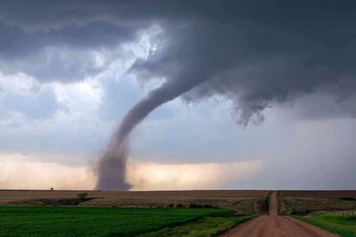
A funnel cloud spun over northern Delaware as storms damaged parts of New Castle County, underscoring how fast a radar warning can turn into real trouble on the ground.
Story Snapshot
- Storms produced a funnel cloud and localized damage in New Castle County, Delaware.
- National Weather Service systems log time, place, strength, and impacts from verified reports.
- Radar rotation and warnings are not the same as a confirmed tornado touchdown.
- Officials confirm tornadoes after damage surveys and vetted ground evidence.
What Officials Track When Storms Hit
National Weather Service offices collect storm details from many sources. Staff draw on damage surveys, emergency managers, law enforcement, trained spotters, and media reports. They record where and when an event happened, how strong it was, and what it damaged. That system builds the official record for tornadoes, wind, hail, injuries, and deaths. It is designed to separate real impacts from hype and to guide warnings that can save lives.
During the Delaware storms, radar showed strong rotation near Wilmington and New Castle County. That kind of tight spin on velocity data often triggers a tornado warning. It tells people to take cover now. But a warning based on radar is different from a confirmed tornado on the ground. Confirmation comes later, after trained teams look at damage or review solid photos and video that prove a circulation reached the ground.
From Funnel Cloud Sighting to Confirmed Tornado
A funnel cloud means a rotating column of air is extending from the storm base but may not be reaching the ground. If it reaches the ground and causes damage, it becomes a tornado in the record. National Weather Service rules call for on-site inspections when needed. Survey teams check how trees fell, what structures failed, and how debris lined up. That helps them decide if winds were straight-line or tornadic, and to assign an Enhanced Fujita rating.
Public databases group these events by county and date. They show how many tornadoes, severe wind, and hail reports occurred in a place like New Castle County. Users can search by county to see entries for tornadoes, wind, and hail going back decades. These tools help emergency managers plan and help residents understand their local risk. They also make clear that a radar-based warning and a confirmed tornado are logged differently.
Why This Matters for Families and Local Businesses
Storms that spin up fast give little time to act. Families and small businesses need plain guidance they can trust. Weather offices aim to warn early, then verify carefully. That balance protects lives without crying wolf. It also respects property owners who shoulder repairs when wind and debris cause harm. Clear records by time, place, and impact support fair insurance claims and smarter building choices the next time storms line up.
The National Weather Service has cancelled Tornado Watch 705 for New Jersey, southeastern Pennsylvania and Delaware. The tornado threat is over, NWS Mount Holly said at 6:15 p.m. EST.
Flash flood warnings remain this evening in parts of New Jersey — Monmouth and Ocean counties…
— Alex Reed (@Trader_GG_USA) November 13, 2026
People on the left and right share a basic ask here: give us facts we can use, simple and fast. The process does that when it works as built. Radar spots risk. Spotters and first responders add ground truth. Survey teams confirm what hit and how hard. For Delaware’s storm, that means a funnel cloud on camera and damage in New Castle County feed into the official log, which helps the next warning be even better.
Sources:
facebook.com, weather.gov, graphical.weather.gov